Kotora Melnkalne: Meaning, History, Location, and Complete Guide to Kotor, Montenegro

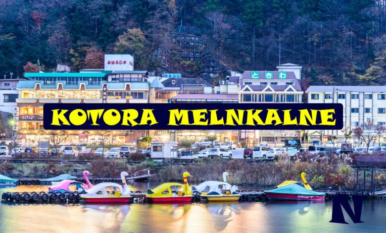
Kotora Melnkalne is a Latvian-language geographical reference to Kotor in Montenegro. The wording can look unfamiliar to English-speaking readers, but it does not identify a mysterious new city or a separate destination. The Latvian National Library’s geographical-name database records “Kotora (Melnkalne)” and gives “Montenegro–Kotor” as its English equivalent.
The place behind the keyword is Kotor, a historic coastal town within Montenegro’s Boka Kotorska, commonly called the Bay of Kotor. Its fortified settlements, historic buildings, dramatic mountain landscape, and maritime heritage form part of the Natural and Culturo-Historical Region of Kotor, which UNESCO added to the World Heritage List in 1979.
What Does Kotora Melnkalne Mean?
Kotora Melnkalne is best understood through Latvian geographical usage. The National Library of Latvia maintains an authority record titled “Kotora (Melnkalne).” The same record provides alternative and foreign-language forms, including the English “Montenegro–Kotor.” This offers much stronger evidence for the term’s meaning than descriptions that present Kotora Melnkalne as an independent tourist destination.
In Latvian, “Melnkalne” is the name used for Montenegro. “Kotora” refers to Kotor in this geographical context. The phrase therefore points readers toward Kotor, Montenegro. This also explains why Latvian-language accommodation pages can display addresses containing “Kotora, Melnkalne.”
This distinction is useful for anyone who finds the keyword through a search engine. English-language maps, international travel information, UNESCO records, and most tourism material use “Kotor, Montenegro.” Searching that name will normally provide more authoritative and practical results.
Where Is Kotora Melnkalne Located?
The destination represented by Kotora Melnkalne is Kotor, situated in Montenegro on the Adriatic coast. Kotor lies within Boka Kotorska, a striking bay where historic settlements occupy narrow areas between the water and steep mountains. UNESCO describes its protected region as covering the best-preserved inner, southeastern portion of the bay.
The landscape is one of the reasons Kotor has such a distinctive appearance. According to UNESCO, mountains surrounding the protected bays rise rapidly to almost 1,500 metres. Historic towns, settlements, palaces, religious complexes, cultivated land, rocky slopes, and the water itself combine into a closely connected cultural landscape.
For practical purposes, travelers looking for Kotora Melnkalne should search for Kotor when using international maps or planning transportation. “Kotor, Montenegro” is the standard English geographical form.
The History Behind Kotor
Kotor’s importance is much older than the modern search term Kotora Melnkalne. Its protected natural harbour helped the settlement develop into an important centre of trade, craftsmanship, religion, navigation, and regional culture. During the Middle Ages, the harbour was particularly significant for artistic and commercial activity.
UNESCO notes that Kotor developed respected schools of masonry and iconography. The wider region also became an important point through which Mediterranean cultural influences reached the Balkans. Its churches, fortified towns, urban layouts, palaces, monastic buildings, and other surviving structures provide physical evidence of this long history.
Venetian influence is especially important when examining Kotor’s architecture and maritime history. UNESCO describes Kotor and neighboring settlements as important Venetian bridgeheads on the southern Adriatic. Communities of captains and shipowners helped make the region a significant creative centre whose artistic and architectural traditions influenced other areas of the Adriatic coast.
Kotora Melnkalne and the UNESCO World Heritage Site
One of the strongest reasons for Kotor’s international importance is its UNESCO status. The Natural and Culturo-Historical Region of Kotor was inscribed on the World Heritage List in 1979 under cultural criteria (i), (ii), (iii), and (iv). The designated property covers approximately 14,600 hectares.
UNESCO does not protect only a single building in Kotor. The designation recognizes a broader cultural landscape that includes architecture, fortified and open settlements, religious sites, palaces, historic urban patterns, and the relationship between human construction and the surrounding terrain. This connection between cultural heritage and natural setting is central to Kotor’s identity.
The region’s preservation has also faced serious challenges. A major earthquake in 1979 damaged many monuments, including Romanesque churches and sections of the town walls. Restoration work followed, with UNESCO providing substantial assistance.
Kotor was placed on the List of World Heritage in Danger in 1979 following the earthquake and remained there until 2003. Its later removal reflected progress in addressing the principal earthquake-related threat, although conservation and development pressures continue to require careful management.
Architecture and the Historic Character of Kotor
Architecture is central to understanding why searches for Kotora Melnkalne lead to such a culturally important place. Kotor’s historic environment developed through centuries of maritime connections, political changes, craftsmanship, and Mediterranean influence.
The fortified urban landscape is particularly significant. Defensive walls, compact streets, churches, public spaces, houses, and palaces create a historic townscape shaped by the limited land between the mountains and the bay. Rather than existing separately from the landscape, these structures appear closely connected to it.
UNESCO specifically highlights the quality of the region’s architecture and the way fortified towns, open settlements, palaces, and monastic ensembles fit into cultivated terraces and rocky slopes. This combination is an important part of the property’s Outstanding Universal Value.
Walking through Kotor therefore offers more than a collection of individual monuments. The arrangement of streets, buildings, walls, water, and mountains helps explain how geography influenced everyday life, defense, commerce, and construction.
Kotor’s Maritime Heritage
The sea has shaped Kotor for centuries. Its protected position within Boka Kotorska provided a natural harbour and supported connections with other parts of the Adriatic and Mediterranean worlds.
Maritime activity helped create communities of merchants, sailors, captains, craftspeople, and shipowners. Commercial links also allowed artistic and architectural ideas to move between coastal settlements. UNESCO’s description of the World Heritage property emphasizes the historical importance of Kotor and neighboring towns in spreading Mediterranean cultures into the Balkans.
This maritime history remains visible in Kotor’s urban form. Defensive architecture reflects the need to protect an important settlement, while churches and historic buildings reveal the prosperity and cultural connections that maritime commerce could generate.
For modern visitors, the bay may first appear to be a scenic backdrop. Historically, however, it was fundamental to Kotor’s development and identity.
The Natural Landscape Around Kotora Melnkalne
The scenery surrounding Kotor is as important to its character as the buildings themselves. Boka Kotorska contains calm coastal waters framed by mountains that rise sharply from the shoreline. This geography creates the dramatic landscape frequently associated with Kotor in travel photography.
UNESCO describes the World Heritage property as two interrelated bays surrounded by mountains rising rapidly to nearly 1,500 metres. A narrow channel links the protected portion with the remainder of Boka Kotorska, creating an important visual connection through the landscape.
The steep terrain historically limited where settlements could develop. Communities consequently grew in close relationship with the coast, mountain slopes, and available agricultural areas. This is one reason UNESCO evaluates the region as an integrated cultural landscape rather than treating its historic monuments as isolated structures.
Today, visitors can experience these contrasts simply by moving between Kotor’s stone streets, waterfront areas, surrounding settlements, and higher viewpoints.
What to See in Kotor
Visitors searching for Kotora Melnkalne are usually interested in the real sights and experiences available in Kotor. The historic urban area is the natural starting point. Its narrow streets, squares, religious buildings, old houses, palaces, gates, and defensive structures allow visitors to experience the town at walking speed.
The fortifications are another defining feature. UNESCO specifically identifies the town walls among Kotor’s important historic monuments. Their relationship with the steep landscape shows how defense and geography worked together.
Historic churches are also significant. UNESCO notes four Romanesque churches when discussing monuments damaged during the 1979 earthquake, illustrating the architectural importance of religious heritage within the protected region.
The wider bay should not be ignored. Exploring beyond the Old Town reveals how Kotor forms part of a larger network of settlements and landscapes rather than standing alone.
Culture and Everyday Life in Kotor
Kotor’s cultural identity developed through its position between the Adriatic maritime world and the Balkan interior. Trade, religion, craftsmanship, navigation, architecture, and changing political influences all contributed to the character visible today.
UNESCO considers the region important partly because of its role in transferring Mediterranean cultures into the Balkans. Its schools of architecture, art, and craftsmanship had an influence beyond the immediate town.
Modern Kotor is also a living community rather than an outdoor museum. Residents live and work within a landscape that attracts international visitors while requiring careful heritage management. This creates a continuing challenge: historic buildings and traditional urban patterns need protection, but the area must also function as a modern place.
Respectful tourism can help visitors appreciate that balance. Historic streets, churches, waterfront spaces, and residential areas are parts of a community as well as attractions.
Conservation and Modern Challenges
Kotor’s survival cannot be taken for granted. The 1979 earthquake demonstrated how vulnerable historic architecture can be to natural disasters. Many monuments were severely damaged, and major restoration efforts were needed. UNESCO played an important role in supporting the town’s recovery.
Today, development creates another challenge. UNESCO warns that uncontrolled or excessive urbanization and infrastructure development can threaten the Outstanding Universal Value of the protected landscape. It also notes concerns about the gradual loss of traditional practices and the harmony between buildings, planning, and landscape.
Conservation therefore involves more than repairing old walls. Authorities must consider new construction, transportation, tourism, landscape management, historic architecture, and the needs of local communities together.
For visitors, this reinforces why responsible behavior matters. A UNESCO World Heritage property is not simply a beautiful background for photographs. It is a cultural resource that requires long-term protection.
Why Kotora Melnkalne Appears Online
The unusual appearance of Kotora Melnkalne has encouraged several interpretations online. Some recent articles describe it as a poetic or creative expression for Kotor. Others correctly connect it with Latvian terminology.
The strongest documentary evidence is more straightforward. The Latvian National Library geographical-name ontology has an official authority entry for “Kotora (Melnkalne)” and identifies the English form as “Montenegro–Kotor.” Latvian-language travel listings also use forms such as “Kotora, Melnkalne” when displaying Kotor addresses.
Therefore, it is safer not to describe Kotora Melnkalne as a newly discovered destination, hidden village, fictional region, or separate tourist attraction. There is no reliable evidence supporting those claims.
The practical interpretation is simple: Kotora Melnkalne refers to Kotor in Montenegro in Latvian geographical usage.
Interesting Facts About Kotora Melnkalne
The first useful fact is that Kotora Melnkalne is connected to a real and internationally recognized historic destination. It should not be confused with a separate town bearing that exact English name.
Kotor’s World Heritage property was inscribed in 1979, the same year that a devastating earthquake caused serious damage to important monuments. The site was placed on the World Heritage in Danger list and remained there until 2003.
Another notable fact is the scale of the protected landscape. UNESCO records the property at 14,600 hectares, showing that the designation extends well beyond a few streets in Kotor’s historic centre.
The region is also notable for the close relationship between human settlement and geography. Mountains, bays, historic towns, fortifications, religious buildings, and cultivated landscapes combine to create the heritage value recognized by UNESCO.
Planning a Visit to Kotora Melnkalne
Anyone planning a trip after searching for Kotora Melnkalne should use “Kotor, Montenegro” when checking maps, transportation, official information, and accommodation. This avoids confusion caused by language differences and ensures that search results point toward the correct destination.
Once there, exploring on foot is an effective way to understand the historic centre. Moving slowly through the streets allows visitors to notice architectural details, public squares, religious buildings, fortifications, and the relationship between the town and its surrounding mountains.
It is also worth allowing time for the wider Boka Kotorska region. The UNESCO property is significant precisely because its heritage is connected across settlements and landscapes.
Visitors should remember that conservation remains an active issue. Respecting historic structures, local rules, religious spaces, and residential areas helps protect the character that makes Kotor internationally significant.
Conclusion
Kotora Melnkalne is not a separate hidden city or newly discovered destination. Reliable geographical evidence connects the term with Kotor, Montenegro. In particular, the Latvian National Library records “Kotora (Melnkalne)” as a geographical name and provides Kotor, Montenegro as its English context.
Kotor itself is far more interesting than the mystery surrounding the keyword. Its natural harbour, historic streets, fortifications, churches, maritime traditions, and dramatic mountain setting tell a story developed over centuries. UNESCO has recognized the Natural and Culturo-Historical Region of Kotor as a World Heritage property since 1979.
For readers researching Kotora Melnkalne, the most useful takeaway is simple: continue your research using “Kotor, Montenegro.” That will lead to accurate maps, historical information, travel resources, and official heritage records for the real destination behind the term.
FAQs About Kotora Melnkalne
1. What is Kotora Melnkalne?
Kotora Melnkalne refers to Kotor in Montenegro in Latvian geographical usage. The National Library of Latvia records “Kotora (Melnkalne)” and provides “Montenegro–Kotor” as an English form. It should therefore not be treated as a separate city, country, or newly discovered tourist destination.
2. Is Kotora Melnkalne a real place?
Yes, in the sense that the term points to the real town of Kotor in Montenegro. However, travelers using English-language maps and international travel services should search for “Kotor, Montenegro” rather than expecting to find a separate place officially named Kotora Melnkalne.
3. Why is Kotor famous?
Kotor is famous for its historic architecture, fortified urban landscape, maritime heritage, churches, mountain scenery, and position within Boka Kotorska. UNESCO recognizes the wider Natural and Culturo-Historical Region of Kotor for its architectural quality and historical role in connecting Mediterranean and Balkan cultures.
4. Is Kotor a UNESCO World Heritage Site?
The Natural and Culturo-Historical Region of Kotor has been on the UNESCO World Heritage List since 1979. The cultural property covers about 14,600 hectares and includes historically important settlements and landscapes within the Bay of Kotor region.
5. What should I search for when planning a trip to Kotora Melnkalne?
Use “Kotor, Montenegro” when looking for maps, accommodation, transportation, heritage information, and travel guidance. Kotora Melnkalne reflects Latvian geographical wording, while Kotor, Montenegro is the standard English form and will provide clearer results for practical trip planning.
See more amazing Information visit Novira Magazine